The Western Uplands with Alex
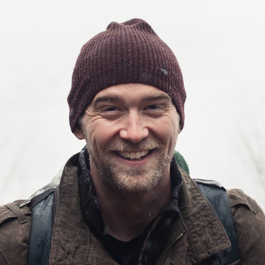
Alex, our Social Media Manager, recently took some time to visit one of the backpacking trails near the Algonquin Art Centre. You can read all about his adventures here!
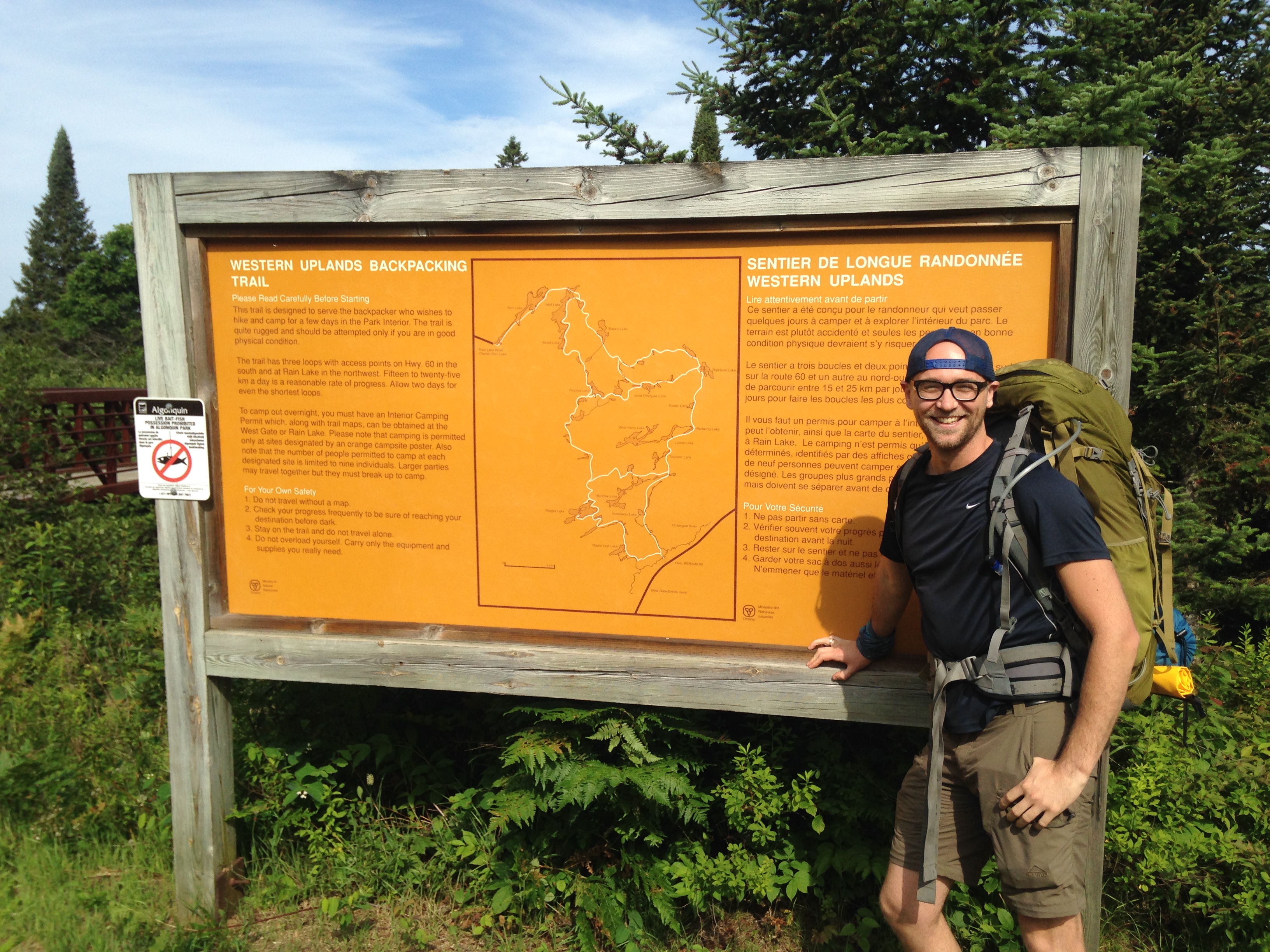
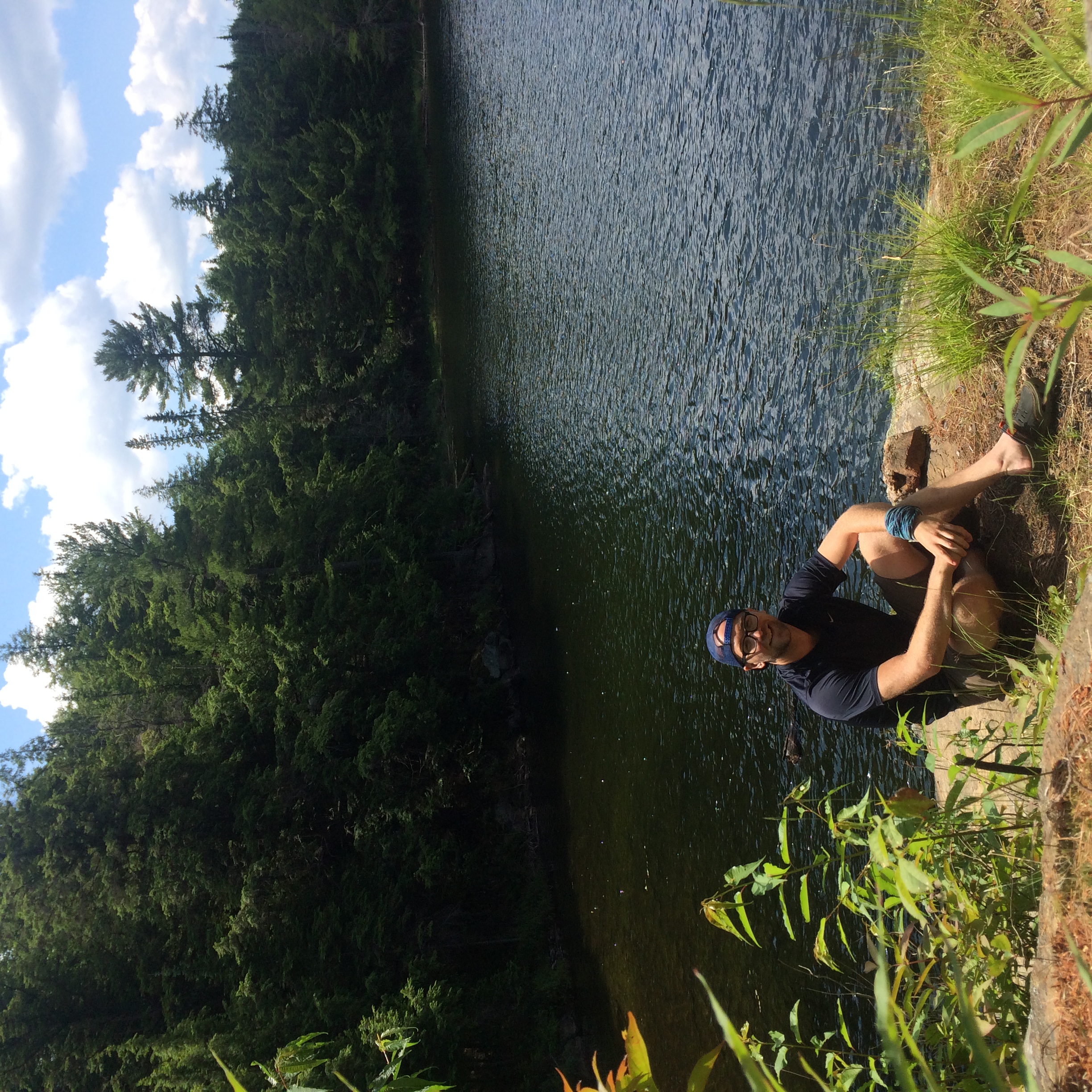
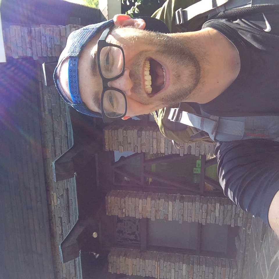
 That’s me! Also, there’s a map of the trail section so you can follow along. Click to enlarge and get a closer look!
I’ve loved backpacking ever since I first hiked the Lake Superior Coastal Trail with my best friend in 2008. The mountains, tundra, and coasts that I’ve hiked since then are amazing, but the Canadian Shield holds a special place for me, so I never miss an opportunity to get out and do a trek in Ontario. This time, it was the Western Uplands trail in Algonquin Park.
I had also been meaning to try out a solo backpacking trip for a while, so I thought this would be a perfect opportunity to take it to that next level in country I’m familiar with. I chose Western Uplands because I wanted to make sure I wasn’t undertaking anything too extreme for my first solo, and you can do a two-night loop, hiking around 12 to 15 km a day. With that in mind, I mustered my gear, caught a ride in with our General Manager Joel and our staffer Jenna, and set out.
Day 1
 Make no mistake. I look cheerful but my flesh is being steadily consumed by insects.
This being late July, the trail’s first impression was “You are now in bug-country. Prepare to pay the blood-tax to your insect-overlords.”
And yes. I definitely did.
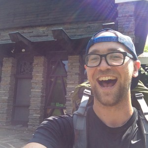
As soon as we snapped that trail-head picture, Joel and Jenna jumped back in the car and headed to the gallery, while I quickly coated myself in Muskol. Health-concerns aside, Deet is one of our greatest achievements as a species. Once I was sprayed down, the bugs left me pretty well alone, so I booted up and got on the trail.
My first night’s destination was West Maggie Lake, about 16 km in a winding, north-westerly direction.
This part of Algonquin maintains a pretty high elevation, which forces the clouds to drop a lot of their precipitation to the west of the park. The vegetation is much denser and more varied than where I’ve done most of my Algonquin hiking, in more easterly places like the Highland Trail and Centennial Ridges. Day one was a lot of dense bush, crossing streams and bogs, and steadily climbing to the high lake where I’d be camping.
There weren’t too many people on trail. I did, however, face a great deal of territorial posturing from some very gutsy collared grouse. They look like a greyish, mottled turkey, and they scoot around with their heads down until you get too close. Then—POOF—they shoot up, puff out their tail and collar, and rush you! It can be pretty startling to be honest, but you just keep on forging ahead and they leave you alone. After a while, it’s just funny.
I wanted to keep a fairly quick pace, so other than a stop or two when there were enough predatory damsel-flies to keep the mosquitoes at bay, the day was pretty uneventful.
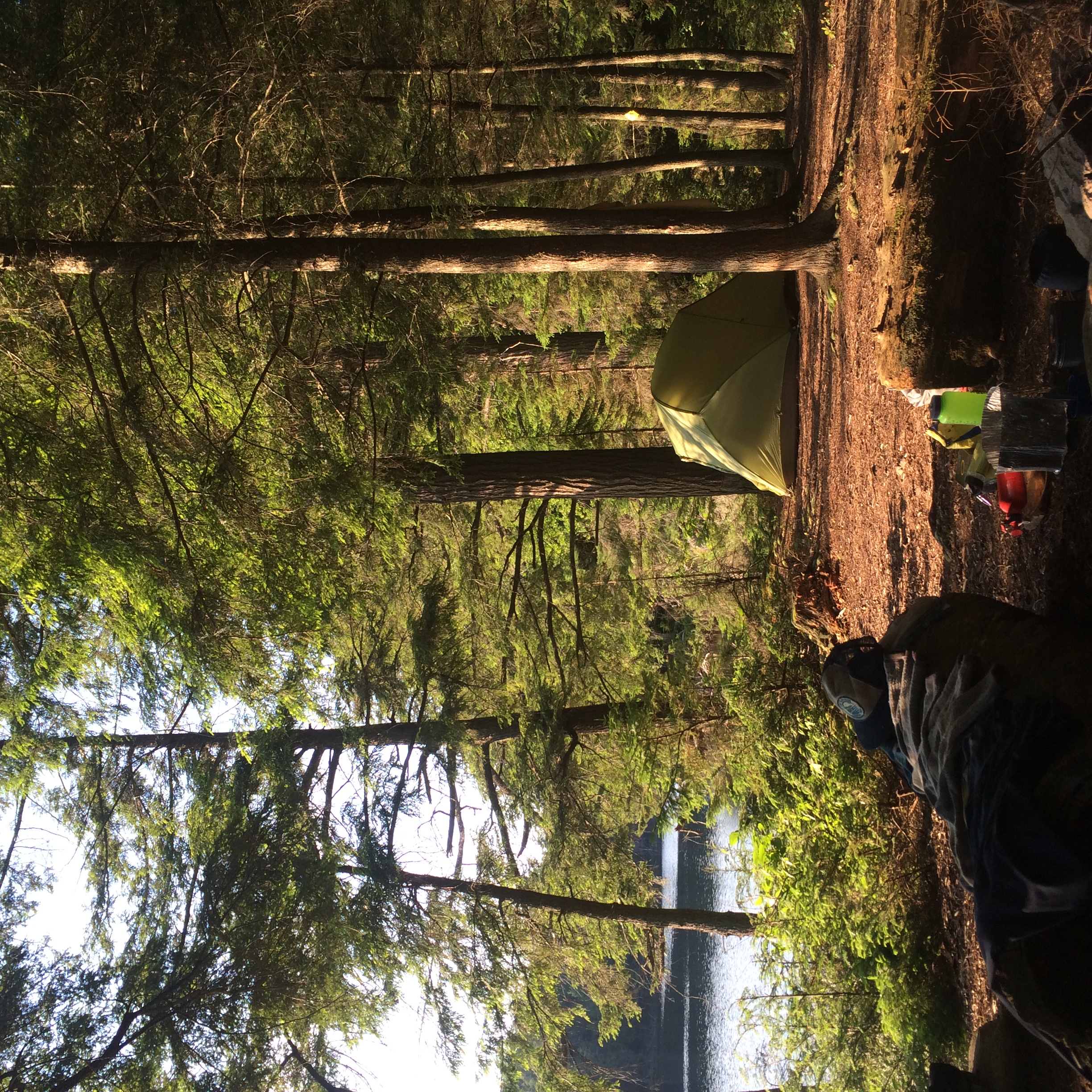
After about 6 hours, I came to the eastern tip of Maggie Lake, where you peel off from the main trail to loop around West Maggie. I trekked along the lake until I found the perfect site. It was at the very western tip of the lake and looked east onto some rocky islands. One look at that view, and I made camp right away.
After getting my site in order, I had two cravings: coffee and washing off.
(Coffee first, obviously.)
After coffee, I was feeling so hot and sticky that I just needed to get refreshed, and Maggie Lake is great for a splash around.
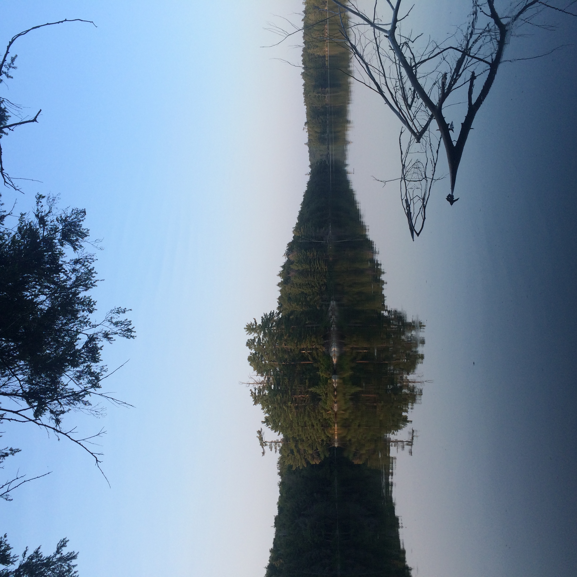
That little island—which probably has a name, but I’m going to call it Spruce Island—was a perfect destination. It gave me the chance for a good 150-meter swim and some warm, flat, shoreline rocks to catch the westerly sun while some enormous spruce trees towered over me.
It was beautiful.
But the sun was getting lower, so I swam back to camp, made my dinner, and after reading my book for a while, secured my bear-hang and turned in for the night.
Day 2
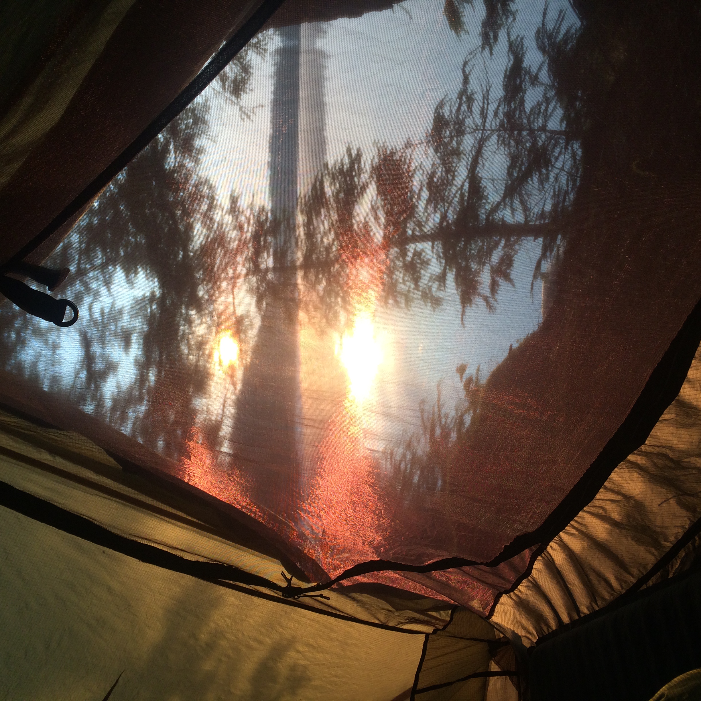
The woodpeckers woke me up just after the sun rose. I can’t tell you how beautiful the view from my tent was, so I’ll just show you.
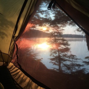 Right??!?
Now, an experienced trekker knows that on any trip longer than two days will have one Hell-day. It’ll never be the first or final day but can otherwise occupy any place in the trip. So, by process of elimination, on a three-day trip you just know you’re going to run into trouble on day two.
Conveniently, I forgot this rule as I woke up, broke camp, and set out.
Don’t get me wrong, the day’s hike was beautiful, especially as I set out around Maggie Lake to meet back up with the main trail. But, day two constituted the top of the trek’s loop, heading east, which hikes you up onto ridges that are both stony and boggy, and inhabited by swarms of mosquitoes. My legs were sore, my pack felt heavy trudging up the largest elevation changes on the trail, and that late coming summer we were having decided to hit me with a day around 29 degrees and dense, humid wetland air.
This is also when the deer flies found me.
I had an exciting moment after climbing out of the Mink Creek ravine when I met a black bear grazing in one of the bogs I trudged through. It’s an interesting feeling, encountering a bear on your own. All the going wisdom and bear-training tells you that in the overwhelming majority of bear sightings, the animal flees as soon as it sees you. But in the back of your mind, there’s that inescapable knowledge in your brain that says “Wow. If it decided to, this animal could really mess me up.”
But I stopped and, as expected, after a few moments the bear noticed me and took off like a shot. No worries!
Not long after that, at about mid-day, I turned onto a side-trail up to Norah Lake. It was a bit more of a climb than I’d like in the middle of a gruelling day, but it’s pretty much the highest point on the trail and I wanted a nice spot to break for a while.
I wasn’t disappointed.
Norah has a beautiful platform of rocks overlooking the water, and I spent a long lunch watching a family of loons fish on the lake. It was exactly what I needed to get some wind back in my sails.
At that point, it was only a couple of hours to my day two destination, Panther Lake. I was a little nervous about this spot, since it only has one campsite and—I’ll admit it—I’m kind of afraid of the dark. That’s multiplied when you haven’t seen a single person all day and you get to thinking about marauding bears and Wendigos. Another fun fact: my reading for this trip was The Fellowship of the Ring, and on this night I just happened to be reading about the Black Riders.
So that definitely added to the “alone in the woods” jitters.
Fortunately, Panther Lake had a beautiful site waiting for me, with some of the most enormous spruce trees I’ve ever seen in Ontario. I honestly didn’t know we had them that huge out here. Even though the water-access was a little rough, it made for a great looking spot…
I was way too bushed to think about anything except getting some food in me and getting to bed, so other than a few nervous glances into the trees, I fell asleep pretty quickly.
Day 3
There’s always a mixed bag of emotions on the final day of a trek. You’re sore and tired, but it’s sad to leave the trail behind. Fortunately, this was my shortest day, clocking in at around 11 or 12 km. This leg closes the hike’s loop by coming down out of the highlands and heading south towards the highway, so the trail is also mostly downhill, which was a treat for the legs.
With all that in mind, I took my time and enjoyed the walk. I saw my first human being for about 36 hours around Dace Lake, and from there to the highway there was a steady stream of people just starting out on the trail. They were all friendly and asked questions, mostly about the bugs, and I tried not to have a grizzled, thousand-meter stare as I responded that they weren’t too bad.
Nobody needs that when they’re just starting out…
I only made one substantial stop, at Guskewau Lake, which has to be the most picturesque lake of the whole hike, with rolling hills and good, wide water that makes for a stiff breeze. From there, it was just a straight shot down Guskewau Creek, all the way to the marshy flats around the trailhead. And there I heard the best sound for any trekker at the end of a trip: cars on the highway.
I hitched a ride from a super-nice young couple from New York, and met up with my friends at the Algonquin Art Centre.
 So much fun! NOW I NEED MEAT AND SALT AND FAT.
NOW.
RIGHT NOW.
Final Thoughts
I was pretty pleased with how this trek came together. I ate most of my food, with the exception of my emergency extras. I wore every piece of clothing I carried as well, so it was nice to know I have my garment-packing locked down. Both clothes and food were in the right quantities. I didn’t touch my extra bottle of fuel though, so I’ll learn from that and pack a little less next time.
But all in all, I managed well!
On a personal level, I learned a little about myself. Although I’ve backpacked a lot with close friends and I love that experience, I also took a lot away from this trip. I felt at peace and ease, and found myself really taking the time just to look at the world around me without feeling the need to comment on it. That’s a pretty special feeling for an extrovert like me, and I’ll carry the lesson forward.
My conclusion is this: trekking with a friend is more fun, but by yourself is more beautiful.
I can’t wait for my next trip, whichever kind it is.


